
Old TriMet City Center map
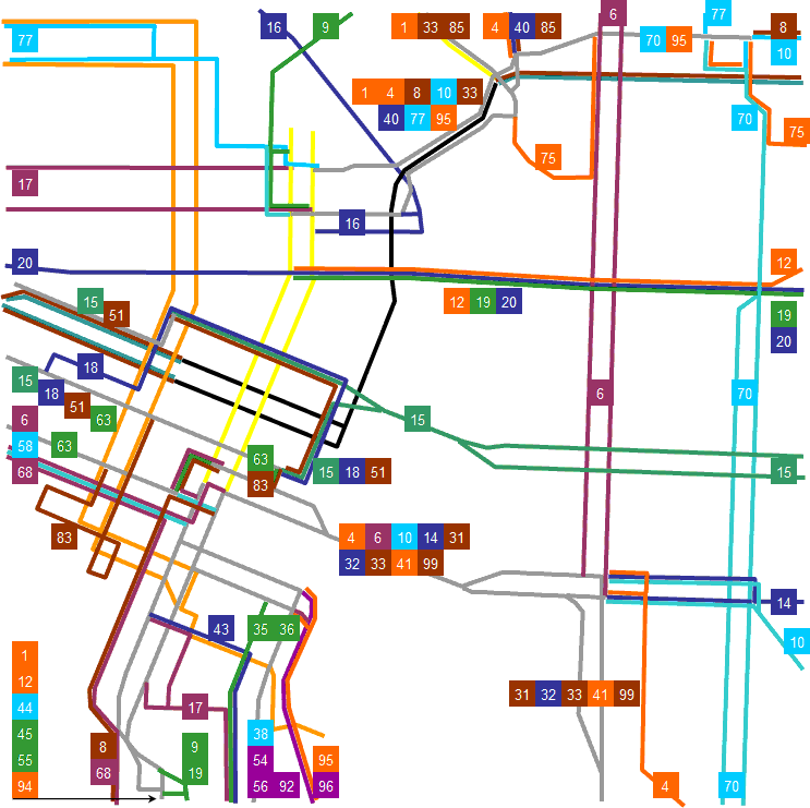
My version of an older map of TriMet service through the center of Portland, Oregon. Unlike the official map, it shows different bus lines in different colors (the ones used on the region map) where feisable. Especially with the closure of the Portland Mall, it is no longer current. (See current one here)
Made by me, by tracing an older version of the official map in Microsoft Word 2002 ("XP") and converted to a Windows Metafile using Microsoft PowerPoint and then Scalable Vector Graphics using OpenOffice.org. Finally, cleaned up using Inkscape.
This map is also available in SVG format at Wikipedia and in a smaller file size